


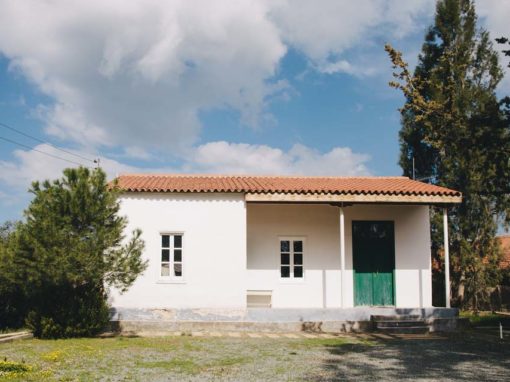
Kakopetria Community Council


Kakopetria is located in the southwestern part of the Nicosia capital and is built at the foot of the Troodos Mountain range, in particular on the north side of the mountain range. It is located at an altitude of 667 metres and is the highest village in the valley of Solea. The community has about 1,300 permanent residents.
There are three version as to from where the name Kakopetria came:
- Kakopetria is said to have gotten its name by the Greek words for ‘bad’ and ‘stone’, because in earlier times its location was not only rocky but also difficult to cross on foot.
- Close to the big bridge at the entrance of the village there is a large stone, known as the Stone of Androgynos. Traditionally, newly-married couples would sit on this stone to aid fertility and bring a happy marriage. One day the stone rolled and crushed the newly married couple. After this event, the inhabitants called the stone ‘Kakopetra’ (Bad Stone) and then the village was named Kakopetria.
- One of the rulers of Marathasa had 3 sons, one of whom was called Petris. Petris was naughty, hyperactive, intolerable and bad. His brothers were fed up with his behaviour and asked their father to send him away. The father sent him to the other side of the mountain. So poor Petris arrived in the area of the old village. He was the first settler. With the words Kakos (Bad) and Petris (the Greek word for Peter, also means stone) the village was named Kakopetria.
For more information about the village you can visit the official website or contact the Community Council.
Contact info
Address: 20 Arch. Makarios Str., 2800, Kakopetria
Tel.: +357 22 922999
Fax: +357 22 922288
Email: kakopetriaeu@cytanet.com.cy
Website: http://www.kakopetria.eu/
Location
Community Councils
Community Council of Agios Theodoros Soleas
Ascending from Nicosia to the Troodos mountain range, just before Evrychou village, to the left, in the forest, one can see some of the first houses of Agios Theodoros Village. The name is derived from the church of Saint Theodore the crusader (Agios T

Community Council of Evrychou
Evrychou, a picturesque village of Nicosia, the rural centre of Solea, is located about 50 km southwest of Nicosia and 30 km from Troodos. It is located on the old road of Nicosia – Troodos. Evrychou is built on the eastern bank of the Karkotis River,
Community Council of Kaliana
The village of Kaliana is located in the valley of the river Karkotis and at an altitude of 600 m. From Nicosia is about 60 km. The landscape is divided from the river network of the river, while in the south and west of the settlement the relief becom

Community Council of Kannavia – Ayia Irini Kannavion
Kannavia is located on the northern slopes of Troodos and about 52 km southwest of Nicosia. Walking in the village, one will see houses of both modern and folk architecture, country houses and a tourist area. Continuing the tour, the visitor will have

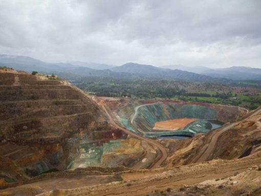
Community Council of Katydata – Skouriotissa
The village of Katydata is about 56 km from Nicosia. Two rivers cross it, the Karkotis and Setrachos. The only active mine in Cyprus, which continues to produce copper cathodes, is located in Katydata. Skouriotissa’s deposits are connected, like all su

Community Council of Koutrafas
The village of Kato Koutrafas is located a few kilometres after Astromeritis to Troodos. It is an abandoned village and its few inhabitants are mainly engaged in agriculture and livestock farming. The church of the village is dedicated to the Virgin Ma
Community Council of Sina Oros
The small village of Sina Oros (Mount Sinai) in the Solea region is now abandoned, since there is only one coffee shop operating in the centre of the village. Surrounded by an exquisite natural environment, it has an amazing climate and its unique hous

Community Council of Spilia
The village of Spilia is located in the heart of the “Brothers” forest. From here comes the river Atsas, whose valley is full of fruit trees and vegetables. For lovers of nature, a visit to the village of Spilia can also be combined with a walk through

