


Kakopetria Community Council


Kakopetria is located in the southwestern part of the Nicosia capital and is built at the foot of the Troodos Mountain range, in particular on the north side of the mountain range. It is located at an altitude of 667 metres and is the highest village in the valley of Solea. The community has about 1,300 permanent residents.
There are three version as to from where the name Kakopetria came:
- Kakopetria is said to have gotten its name by the Greek words for ‘bad’ and ‘stone’, because in earlier times its location was not only rocky but also difficult to cross on foot.
- Close to the big bridge at the entrance of the village there is a large stone, known as the Stone of Androgynos. Traditionally, newly-married couples would sit on this stone to aid fertility and bring a happy marriage. One day the stone rolled and crushed the newly married couple. After this event, the inhabitants called the stone ‘Kakopetra’ (Bad Stone) and then the village was named Kakopetria.
- One of the rulers of Marathasa had 3 sons, one of whom was called Petris. Petris was naughty, hyperactive, intolerable and bad. His brothers were fed up with his behaviour and asked their father to send him away. The father sent him to the other side of the mountain. So poor Petris arrived in the area of the old village. He was the first settler. With the words Kakos (Bad) and Petris (the Greek word for Peter, also means stone) the village was named Kakopetria.
For more information about the village you can visit the official website or contact the Community Council.
Contact info
Address: 20 Arch. Makarios Str., 2800, Kakopetria
Tel.: +357 22 922999
Fax: +357 22 922288
Email: kakopetriaeu@cytanet.com.cy
Website: http://www.kakopetria.eu/
Location
Community Councils

Flassou Community Council
Flassou is a mixed village in the area of Solea in Nicosia, about 3 kilometers northwest of Evrychou village. The community is built in the valley of the Karkotis River, at an average altitude of 330 meters. The altitude of the village is between 250

Galata Community Council
The Galata community is built at an altitude of 620 metres above sea level on the banks of the Karkotis River, surrounded by lush greenery of wild and fruit trees, with impressive wooden balconies and wooden stairs of old traditional houses, the six By
Korakou Community Council
Korakou was a mixed race village (Greek Cypriots and Turkish Cypriots) of the Nicosia District until 1964. After then, it was only populated by Greek Cypriots. It is located in the geographical region of Solea, about 51 km southwest of the capital, Nic

Kourdali Community Council
The history of Kourdali village begins in the 16th century AD, the century when the monastery of Panagia Chrysokourdaliotissa was built, which was the centre of a monastery that lay around it. Over time, the village grew and the inhabitants also acquir

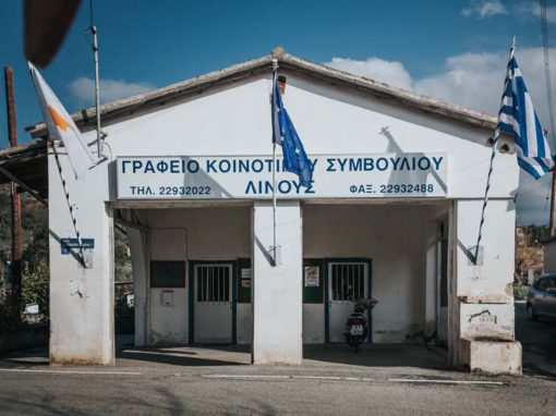
Linos Community Council
Linos is a village in Nicosia, in the geographical region of Solea, about 48 km southwest of the capital Nicosia. In the northeast of the village and within its administrative boundaries, there is the abandoned settlement of Lemones. Linos is built to

Tembria Community Council
Tembria is a beautiful village located in the centre of the Solea valley and is about 60 km from the capital. The average altitude of the village is 500 meters and its highest point is 900 meters. In winter, the climate is cold, while the summer is coo
